Master of Science in Geospatial Sciences
Drone1

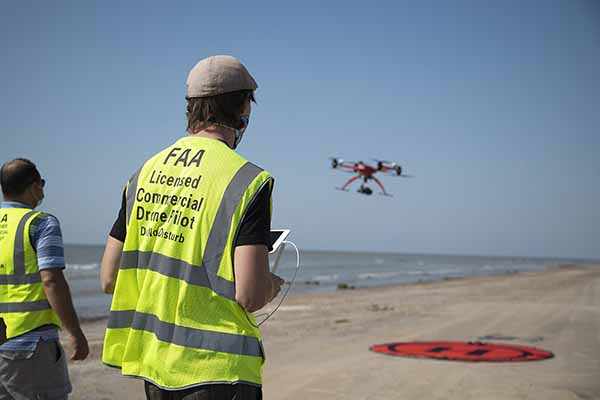
The Master of Science degree in Geospatial Sciences is the first of its kind in Southeast Texas. Our program will provide education in all key areas of geospatial technologies most relevant to the contemporary workplace, including computer-based geographic information systems, remote sensing techniques, Drone technology, digital image processing, spatial analysis and modeling, global positioning systems and data science in the big data era. Students in the program will be given practical experience in the application of state-of-the-art geospatial-based systems to a wide range of real-world programs. 

The field of geospatial sciences has become an integral aspect for supporting decision making in a variety of fields such as physical and environmental sciences, urban planning and management, political science, civil engineering, economy, business, real estate, education administration and health care.

Interested in Applying?

Our master's program in geospatial sciences is open to all students in any discipline. If you wish to pursue a master's degree in geospatial sciences at Lamar University, you must have a bachelor's degree from an accredited institution and must meet the admission standards of the College of Graduate Studies

The program is delivered through a combination of face-to-face and online instruction.

Courses

The program will include a 30-credit hour thesis-based option or a 36-credit hour non-thesis option. The curriculum is designed to train individuals to work in any sector of geospatial sciences and to offer you the combination of technical training, critical thinking skills and the ethical framework necessary to be effective geospatial analysts. 

Thesis-based Master’s program

The thesis-based M.S. in geospatial sciences is a 30-credit graduate program comprised of 15 credits of core courses and 9 credits of elective courses and 6 credits for thesis work.

  • Required Courses (4 courses), 15 credits:

Course Number

Course Name

Credit Hours

Semester

GEOL 5311

Fundamentals of GIS

3

Fall & Spring

GEOL 5312

Advanced GIS

3

Fall & Spring

GEOL 5314

Fundamentals of Remote Sensing

3

Fall

GEOL 5398

Thesis

6

Fall/Spring


  • Elective Courses (select only 5 courses), 15 credits:

Course Number

Course Name

Credit Hours

Semester

GEOL 5316

Remote Sensing for Environmental Analysis

3

Spring

GEOL 5303

GPS Methods and Applications

3

Fall

GEOL 5313

GIS Research Project

3

Fall & Spring

CVEN 5370

GIS Applications in Engineering

3

Spring

COSC 5311

Advanced Data Mining

3

Fall

COSC 5340

Advanced Data Science and Big Data Analysis

3

Spring

GEOL 5301

Drone Photogrammetry and Applications

3

Summer

GEOL 5301

Independent Study

3

Fall & Spring

Non-thesis-based Master’s program

The non-thesis M.S. in geospatial sciences is a 36-credit graduate program comprised of 18 credits of core courses and 18 credits of elective courses.

  • Required Courses (12 courses), 36 credits:

Course Number

Course Name

Credit Hours

Semester

GEOL 5311

Fundamentals of GIS

3

Fall & Spring

GEOL 5312

Advanced GIS

3

Fall & Spring

GEOL 5313

GIS Research Project

3

Fall & Spring

GEOL 5314

Fundamentals of Remote Sensing

3

Fall

GEOL 5316

Remote Sensing for Environmental Analysis

3

Spring

GEOL 5303

GPS Methods and Applications

3

Fall

CVEN 5370

GIS Applications in Engineering

3

Spring

COSC 5311

Advanced Data Mining

3

Fall

COSC 5340

Advanced Data Science and Big Data Analysis

3

Spring

GEOL 5301

Drone Photogrammetry and Applications

3

Summer

GEOL 5301

Independent Study

3

Fall, Spring

GEOL 5301

Independent Study

3

Fall, Spring