SRA grants $100K to LU led project to mitigate flooding in Southeast Texas
The Sabine River Authority of Texas awarded Lamar University $100,000 to help initiate the Southeast Texas Flood Coordination Study, a collaborative project designed to help the region improve its resiliency during
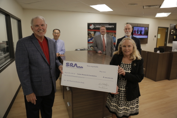
David Montagne, Jerry Lin, Brian Craig, Ken Evans, Liv Hasselbach
large-scale flooding events.
Executive Vice President and General Manager for the Sabine River Authority of Texas presented the check on Tuesday, June 16 to Ken Evans, president of Lamar University; Liv Haselbach, chair and professor of the Department of Civil Engineering in Lamar University’s College of Engineering and project team leader; Jerry Lin, associate provost for research director, Center for Advances in Water and Air Quality; and Brian Craig, dean of the College of Engineering.
“On behalf of the Board of Directors of the Sabine River Authority, we have a very robust community grant program; we help people in flooding events, and we spend most of the money at home helping small communities that have problems with their water treatment or waste water, but this was real important to us,” said Montagne, who is also a regent of the Texas State University System. “It’s so important to us because you need information to make things better and you don’t win projects if you don’t have good information. This project is going to give the state much better information.”
Montagne’s role as a regent and his ability to facilitate the substantial donation to the project contributed to its significance.
“Liv and her team have been dedicated to looking at more effect ways of helping map the flooding,” said Evans. “Your compassion for the community, your leadership in the Sabine River Authority and, more importantly and from our standpoint, your leadership in the Texas State University System is greatly appreciated. Thank you for making these dollars possible to help facilitate what Liv is doing.”
The project will include local, regional, state and federal agencies and industry groups, municipalities and universities to fund a data collaborative and communication network to ultimately serve as a prototype for regional flood mitigation and response with the potential to expand the model statewide.
The group of organizations will seek to gather data and coordinate storm water modeling and decision making to support the State Flood Plan as well as launch a networked, information team in Southeast Texas to support information exchange and emergency response. Ideally, the collaborative effort of data collection and shared resources will result in flood mitigation and sensor technologies in Southeast Texas and a maintenance plan for a Southeast Texas Flood Coordination Group.
“My hope is that this project establishes a long-term, permanent service hub to serve Southeast Texas’ eight counties and serves as a model for other regions,” said Haselbach. “Through our efforts, we can provide better data so that the modelers can make better decisions to mitigate flooding. If data is updated, then during the events modelers can predict flooding likelihood and help emergency responders know how to re-route emergency supplies to areas most in need.”
Haselbach and a team of core team research organizations (See core team listing below.) believe that through their work they will formulate a geographic information system database for SETX to support studies of the interaction of the streamflow and the transportation networks and other development and industry. The GIS database can then integrate with national efforts from FEMA, USGS, NWC, NOAA, etc. on mapping, flood prediction, inundation and response. In the long term, the group believes it can then expand the database with data to support hydrological modeling, integration with emergency response needs and decision making in targeted flood mitigation strategies.
“This whole collective has been initiated to help Southeast Texas mitigate, respond to and recover from a major event, and I’m so excited that SRA is providing this kind of significant support.”
Core Team
Lamar University: Liv Haselbach (Team leader), Xing Wu (GIS), Qin Qian (Hydrology), Brian Craig (Industry), Nicholas Brake/Thinesh Selvaratnam (Infrastructure), Natalie Tindall (Communications)
University of Texas: David Maidment (Lead), Harry Evans (Response), Christine Thies (Response, GIS), David Arctur (GIS), Clint Dawson (Map Integration)
Texas Department of Transportation: Adam Jack, Andrew Lee
Texas Department of Emergency Management: Carman Apple
Texas Department of Public Safety: Capt. Michelle McDaniel
United States Army Corps of Engineers: Sarah Delavan, Alicia Rea
Local Drainage Districts: Doug Canant (DD6 Jefferson County), Don Carona (Orange County), Phil Kelley (DD7 Jefferson County)
County Floodplain Managers: Steve Stafford (Jefferson), Lisa Roberts (Orange), Brad Wilber (Chambers)
US Geological Survey: Alan Rea (Chief Scientist National Hydrography Dataset), Jason Stoker (National Lead Elevation), Jeff Danielson (CoNED Applications Project Chief)
River Authorities: Scott Hall (LNVA), Mark Howard (SRA)