Water and Air Quality in the Coastal Environment
Shoreline Protections using EM2 Geomodel tool
Storm surge caused by hurricanes and tropical storms along Texas Coast removes large quantities of sand from the shoreline, erodes significant land area and destroys properties. At Lamar, EM2 Geomodel is applied to investigate shoreline protection solutions that include river and geologic processes. This allows simulation of wave motion and the associated shoreline response, which enables development of shoreline sediment transport models for assessing large scale shoreline erosion.
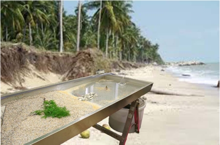
EM2 Geomodel to simulate the Shoreline Protection Measures
Water Resource Management Using Wireless Sensor Network
This development is attempt to accomplish a transformative change in water resource management through application of state-of-the-art Wireless Sensor Networks (WSN) technology, and to apply real-time and large-scale heterogeneous water quantity and quality data collected through the WSN to develop, calibrate and validate water quantity and quality models, and to characterize interactions among water resources, climate changes, and human impacts thus providing more accurate prediction for water resource management under different climate scenarios.
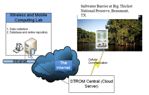
Wireless Sensor Network to Enable Sustainable Water Research
Associate Director for Programs
R. Gavin Jones, REP
Phone: (409) 880-8447
Email: Gavin.Jones@lamar.edu
Address
211, Redbird Ln., ML 10088
Center for Advances in Water & Air Quality
Lamar University
Beaumont, TX 77710-0088